Empowering agribusinesses, sugar mills, input companies, and financial institutions with high-resolution satellite analytics and field-level intelligence.
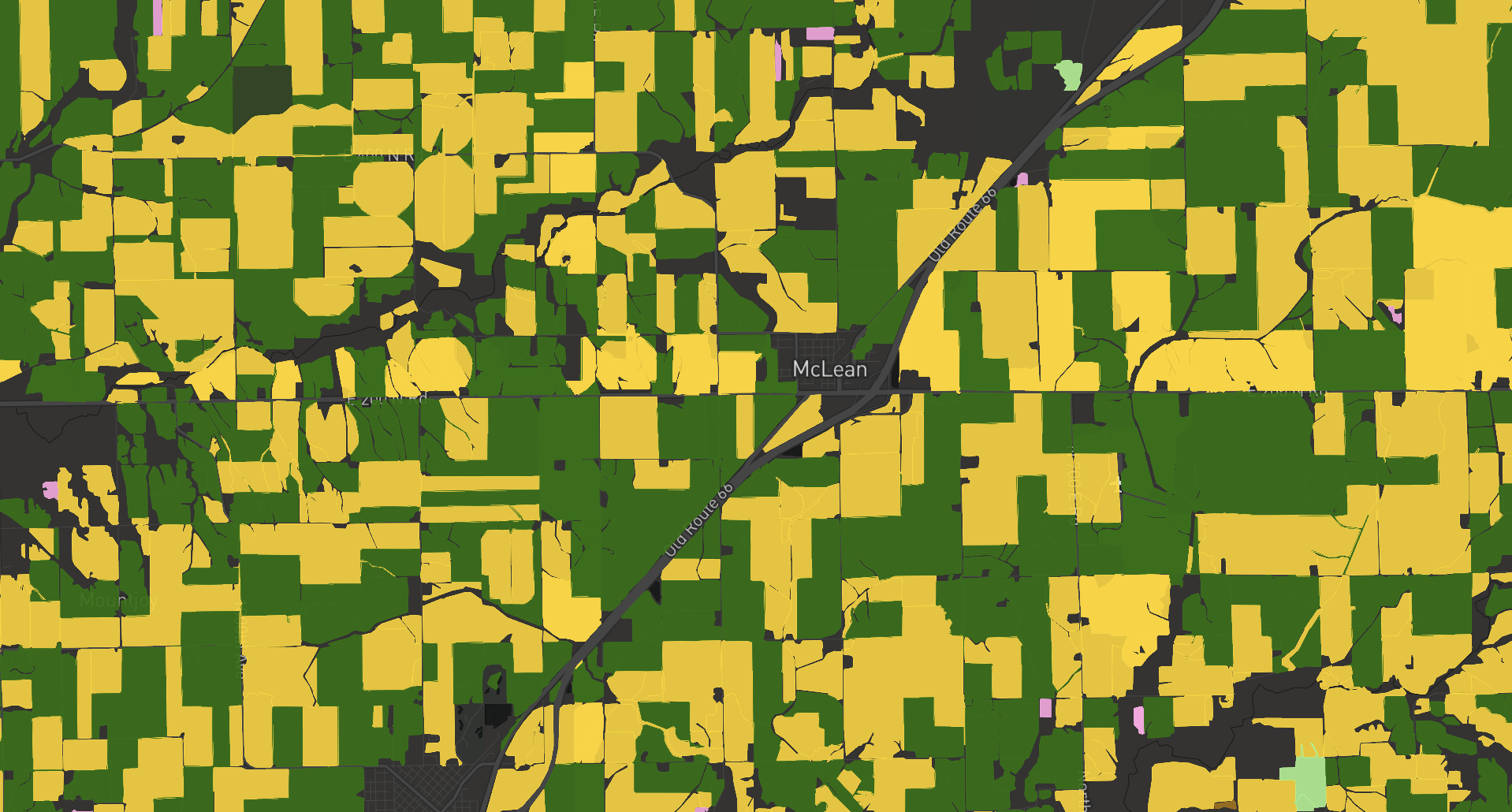
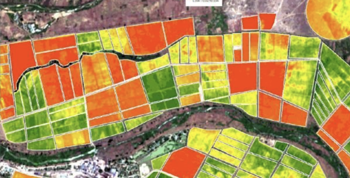
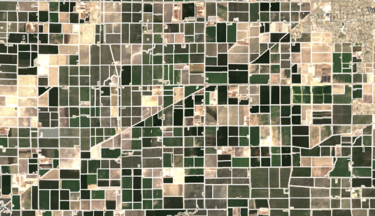
BKK GIS converts complex geospatial data into actionable decisions that improve productivity, reduce risk, and maximize profitability across the entire agricultural value chain.
Built specifically for Pakistan's agriculture ecosystem, our platform delivers field-level intelligence at national scale — combining AI, remote sensing, and ground-truth data into a unified analytics framework.
A complete intelligence platform covering every critical dimension of modern agribusiness operations.
Complete visibility of your agricultural landscape with multi-season mapping.
Monitor crop conditions in real time. Detect problems before they impact yield.
Leverage past data to make smarter future decisions.
Digitize and organize your entire farming ecosystem at scale.
Understand productivity at scale — from farms to national benchmarks.
Full visibility into field-level harvest operations in near real-time.
Informed, data-driven decisions during critical harvest periods.
Designed to support large-scale agricultural operations at mill level.
Stay ahead of threats with automated intelligence and targeted advisories.
We don't just provide data — we deliver decisions that drive action.
Integrate weather intelligence into every stage of decision-making.
Instant understanding powered by an integrated AI assistant.
Purpose-built analytical products that translate satellite intelligence into business outcomes.

Crop types and field boundaries identified with high accuracy using advanced ML and satellite intelligence. Supports procurement planning and regional production analysis.

Early-season biophysical and ML-powered forecasts. Optimize procurement strategies, manage storage capacity, and ensure supply chain stability.

Evaluate crop performance merging satellite data, weather inputs, and ML modeling to deliver reliable yield projections for planning decisions.

Detect field and land boundaries quickly using satellite imagery. Eliminate manual errors and digitize assets at scale for optimized analytics.

Classify land efficiently using multi-spectral satellite data and ML models. Get ready-to-use maps and area statistics for planning decisions.

Track soil moisture across fields using satellite data. Access historical trends for informed, timely irrigation and crop health decisions.
Tailored intelligence for every player in the agricultural value chain.

Purpose-engineered to support farmers, agribusinesses, researchers, and governments with scalable geospatial intelligence worldwide.
AI, remote sensing, and ground-truth data in a unified analytics framework delivering granular insights across every field.
Designed to improve decision-making across the agricultural value chain, enabling measurable gains in yield optimization and cost reduction.
Seamlessly connects with your existing systems to enhance — not replace — your current workflows.
Continuously monitor agricultural landscapes — detect new activity, land conversion, and spatial changes for planning and compliance.
Connect with our agriculture intelligence specialists to explore how BKK GIS can transform your agribusiness decision-making.
Your data is secure and never shared with third parties.